The Beukenberg is a hill in the northern part of the Heuvelland located near Oirsbeek in the Dutch province of Limburg with a height of 115 meters above NAP. The hill is part of the Plateau van Doenrade, on the edge of the Kakkert stream valley.
De Beukenberg is located just north of the center of Oirsbeek. At the top of the slope is the hamlet of Klein-Doenrade. Together with the Duivelsberg to the west and the Boomkensberg to the east, the hill forms a ridge on the northern edge of the Kakkertdal.
The Beukenberg is separated from the Duivelsberg by the Tomkensgrub, a dry valley or grub through which a sunken road runs. The hilltop rises about 35 meters above the valley and is bordered by sloped forest.
The hill was partially excavated in the past for sand and gravel extraction. The resulting quarry has been used as a landfill since the 1970s and has been filled with waste during the following decades.
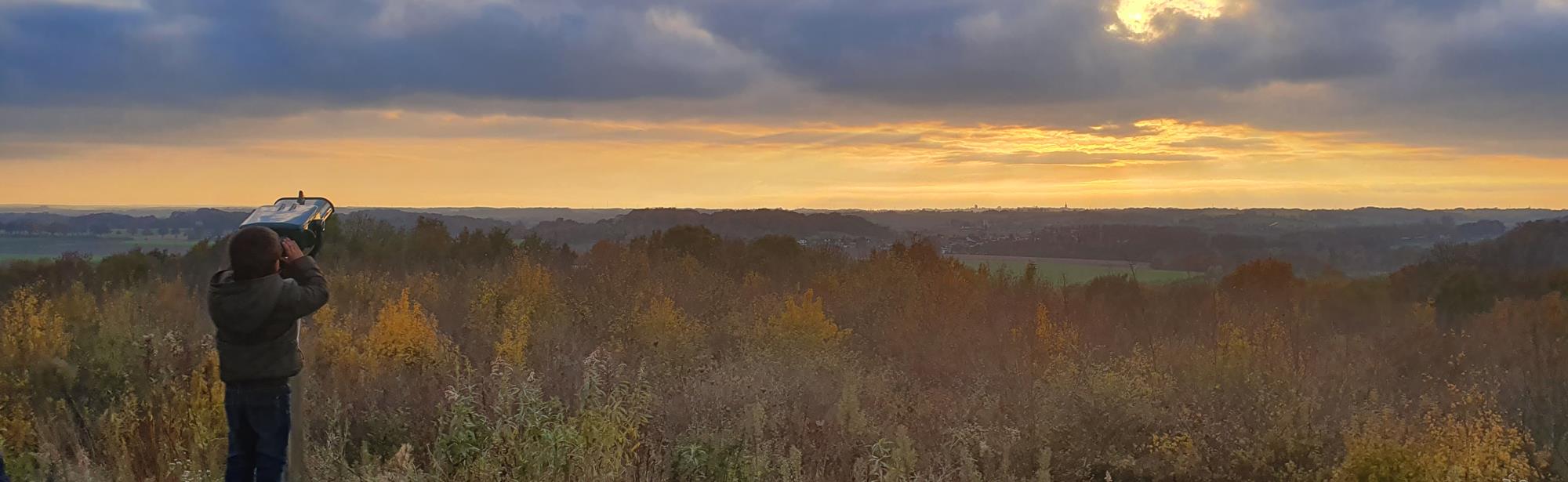
Between 2000 and 2001, the entire site was covered with an impermeable foil and a clean soil layer and finally planted. The area has been open as a walking area since 2005. On top of the hill there is now a lookout point with a beautiful panorama.
The slope of the same name Beukenberg is popular in cycling. This moderately steep climb consists of two parts and climbs over a length of 860 meters from the former hamlet of Gracht in the valley to Klein-Doenrade at the top.
The slope has an average gradient of 3.1 percent. The steepest part of the climb is near the top and has a gradient of around 7 percent.
This text has been automatically translated using an online translation service.
Itineraries in the area
Interesting in this area!
Welcome to Zuid-Limburg!
It’s great that you are here to be inspired!
We use cookies for the purposes of analysing our
website and improving functionality.
Do you want to discover Zuid-Limburg to the maximum?
For further information, please read our cookies policy.
Cookies are small files of information stored by your browser on your computer whenever you visit a website, and that are used, for example, to remember your personal preferences. They provide us with information about how you use our website. We can then continue to improve the website and make it even easier for you to discover Zuid-Limburg.
Functional cookies
For www.visitzuidlimburg.com to function optimally you need cookies. These cookies cannot be switched off and so they are included here for information purposes only. This means that www.visitzuidlimburg.com uses cookies to record whether the website visitor accepts the cookie notice or registers to receive, or not to receive, our newsletter.
Analytical cookies
Analytical cookies provide us with information about the ‘browsing history’ of visitors to our website. We use this information to make our website a little better, day by day. These cookies provide us with an overall picture of surfing behaviour in anonymized form.
Marketing cookies
These cookies help us to tailor advertising to your interests, so that you do not receive irrelevant information.
Personalisation
These cookies enable us to provide you with information that is tailored to your interests, based on the information you were looking for on previous visits to our website.
You can change your cookie settings at any time by changing the settings here or by (locally) deleting the cookies.