Puth & Vogelzang
Schinnen
Puth lies together with Doenrade on a plateau (the Plateau van Doenrade) where an old Roman trade route runs from Germany to Maastricht. This connecting road is now called the Maastrichterweg. The origin of Puth is probably due to this trade route. Despite the high location of the area in question, a population developed here due to the presence of very fertile and easy to work soil.
The name Puth is most likely derived from the deep wells present in this village and was first mentioned in a deed from 1377. It speaks of a knight, listening to the name Jan van Putte.
Puth has traditionally belonged to Schinnen and has only been a fully-fledged church village since the beginning of the 20th century. Before that it consisted of a number of disjointed hamlets, including Onderste Puth, Bovenste Puth and 't Einde. In the 1960s and 1970s, the village experienced its strongest growth with the construction of a residential area southeast of the core. Much of the old buildings have been lost, also because of the construction of the new connecting road with Geleen. A number of half-timbered houses have been preserved, some of which can be qualified as high-quality. Fragments of half-timbering in courtyards can also be found, mainly in Upper Puth. Here and there one still encounters clusters of closed buildings, which are the remnants of the former whole.
†
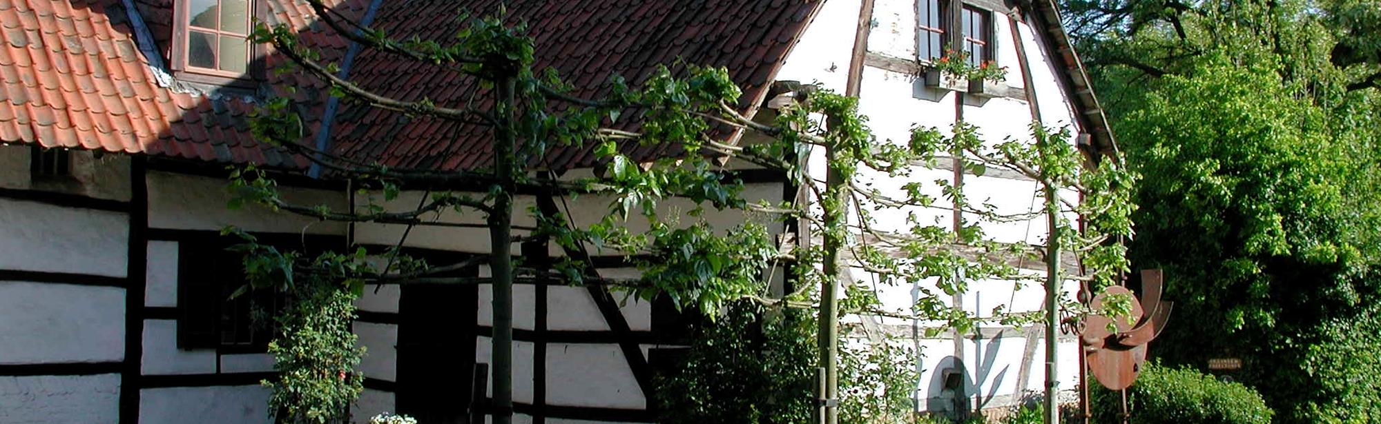
Upper Puth 1, half-timbered house from the 1st half of the 19th century.
†
Kerkweg 153, half-timbered house from 1628, interior with 17th century stucco ceiling.
In the past there were many large farms with often tens of hectares of land. Very little of this remains.
†
The farm Mahove and Hautvast on Geineinde are still a few relics from the past.
†
Hoeve Kerkweg 133, square farm with half-timbering from the 18th century. The brick street facade dates from the 1st half of the 19th century.
Around the village are a number of slopes, including the Keldenaar, the Putherberg and the Zandberg. Southwest of the village is the Stammenderveld, an offshoot of the plateau that has a maximum height of 109.3 m above NAP. The area is popular with cyclists and walkers because of the many climbs, rolling landscapes and views. The Pieterpad and the Pilgrimspad pass through Puth. Directly southeast of Puth you will find the Putherberg, on the edge of the plateau, at an altitude of 108 meters.
To the north of Puth is the Wanenberg nature and recreation area, and to the southwest the Stammenderbos. Agriculture predominates on the plateau.
Itineraries in the area
Interesting in this area!
Welcome to Zuid-Limburg!
We use cookies for the purposes of analysing our website and improving functionality.
For further information, please read our cookies policy.
Change cookie settings
Cookies are small files of information stored by your browser on your computer whenever you visit a website, and that are used, for example, to remember your personal preferences. They provide us with information about how you use our website. We can then continue to improve the website and make it even easier for you to discover Zuid-Limburg.
Functional cookies
For www.visitzuidlimburg.com to function optimally you need cookies. These cookies cannot be switched off and so they are included here for information purposes only. This means that www.visitzuidlimburg.com uses cookies to record whether the website visitor accepts the cookie notice or registers to receive, or not to receive, our newsletter.
Analytical cookies
Analytical cookies provide us with information about the ‘browsing history’ of visitors to our website. We use this information to make our website a little better, day by day. These cookies provide us with an overall picture of surfing behaviour in anonymized form.
Marketing cookies
These cookies help us to tailor advertising to your interests, so that you do not receive irrelevant information.
Personalisation
These cookies enable us to provide you with information that is tailored to your interests, based on the information you were looking for on previous visits to our website.
You can change your cookie settings at any time by changing the settings here or by (locally) deleting the cookies.
Save settings